Snitz Creek
Where can I find it? Snitz Creek joins Quittapahilla Creek directly next to the wastewater treatment plant in North Cornwall Township, about a quarter-mile south of Rt. 422 and a quarter-mile east of Dairy Road, as seen on the Google Map below:
View Snitz Creek Mouth in a larger map
Snitz Creek begins in Cornwall Borough northwest of the old mine and north of Iron Master road. Before it crosses under Rt. 72 its volume is swelled by two lesser runs. The first begins in Cornwall just north of the mine, and the second orginates around the intersection of Rt. 72 & Rt. 117. Flowing north just west of Rt. 72, Snitz Creek turns northwest about half a mile west of the K-mart/Lowes Shopping Center and continues flowing northwest before passing Wengert's Dairy and the North Cornwall wastewater treatment plant and merging with Quittapahilla Creek.
Drainage Area: 12.4 square miles
Stream Length: approx. 7 miles (5.2 miles point-to-point)
Elevation at Origin: 616.8 ft.
Elevation at End: 446.2 ft.
 |
 |
|
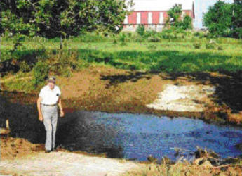
Snitz Creek at Gebhard Farm, October 1999, before fencing (wlith QWA founding member Ray Swingholm In the foreground). |
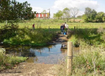
Snitz Creek at Gebhard Farm, October 2000, after installation of fencing to keep livestock from gaining direct access to the stream. |
For additional images of Snitz Creek and the other waterways comprising the Quittapahilla watershed, see the Photos & Images pages.