Beck Creek
Where can I find it? Beck Creek merges with Quittapahilla Creek in the northern portion of South Annville Township, about half a mile south of Rt. 422 and half a mile west of Spruce Street, as shown on the Google Map below:
View Beck Creek Mouth in a larger map
Beck Creek originates near the Gretna Glen Camp west of Rt. 72 on Old Mine Rd next to Rt. 117. Flowing north, the creek runs under Rt. 322 and then Rt. 241 before turning northwest to flow through the Lebanon Country Club and Golf Course and cropland & dairy farms before meeting Quittie Creek.
Drainage Area: 8.13 square miles
Stream Length: approx. 7 miles (5.2 miles point-to-point)
Elevation at Origin: 721.8 ft.
Elevation at End: 416.7 ft.
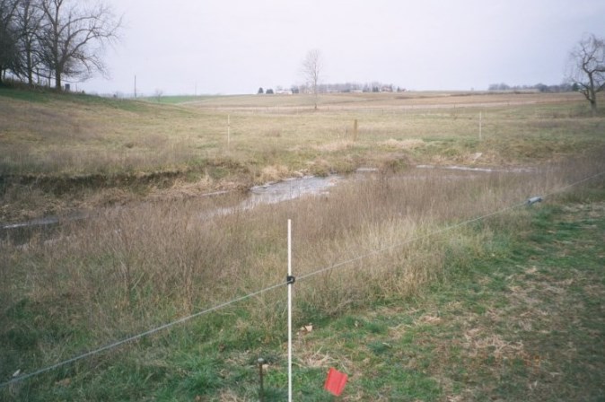
Above: Beck Creek as it flows through Mumma Farm, 2003. This image shows a streambank restoration project in progress, erecting fencing & creating a riparian buffer to prevent livestock from gaining direct access to the stream.
For additional images of Beck Creek and the other waterways comprising the Quittapahilla watershed, see the Photos & Images pages.