Bachman Run
Where can I find it? xxx Bachman Run merges with Quittapahilla Creek on the border between Annville Township and South Annville Township, about a quarter-mile south of Rt. 422 and a quarter-mile east of Mount Pleasant Road, as shown on the Google Map below:
View Bachman Run Mouth in a larger map
Bachman Run originates in the hills along Rt. 241 and intersects Rt. 322 just west of Rt. 934. It continues to flow north west of Rt. 934 through cropland & dairy farms until it flows into Quittapahilla Creek.
Drainage Area: 7.72 square miles
Stream Length: 4.4 miles (point-to-point)
Elevation at Origin: 603.7 ft.
Elevation at End: 423.2 ft.
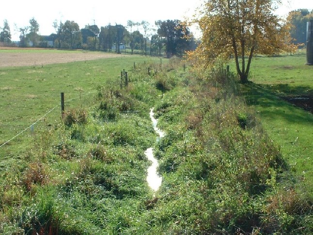
Above: Bachman Run as it flows through Bucher Farm in South Annville Township, 2003. This image illustrates a restored streambank after fencing to prevent livestock from gaining direct access to the stream.
For additional images of Bachman Run and the other waterways comprising the Quittapahilla watershed, see the Photos & Images pages.