Brandywine Creek
This page offers a photographic journey down Brandywine Creek in northeast Lebanon, starting at its headwaters and working our way downstream through residential, commercial & industrial zones to its mouth at the Quittie (all text & photos courtesy of Michael Schroeder and © Quittapahilla Watershed Association).
The most urbanized and by all appearances the most contaminated of the Quittie's main tributaries, the Brandywine originates in a cluster of springs just northeast of the Lebanon Christian Academy near North 8th Ave & Miller Street. Near its headwaters is Stoever's Lake, created by Stoever's Dam, which first became a public recreational site in the 1960s. The first version of the dam was built in the 1820s to supply water to the Union Canal. An upgraded version was completed in 1864. More than a century later, in 1979, the U.S. Army Corps of Engineers declared Stoever's Dam unsafe. Three years later, thanks to the combined efforts of local residents, the dam was rebuilt and a 153-acre public park created, comprised of woodlands, meadows, baseball & soccer fields, picnic areas, hiking trails, and Stoever's Lake, and funded through federal land & water conservation funds as administered by the Pennsylvania Department of Community Affairs (see the "History of Stoever's Dam Park" and the accompanying story, "Stoever's Dam Park" by Amanda Parry, Lebanon Daily News, 10 August 2000).
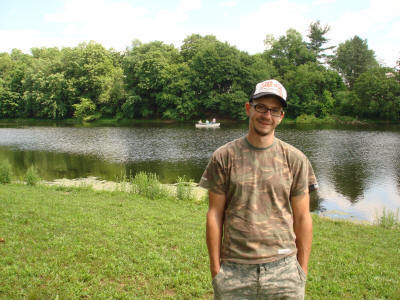
Pictured above right is local resident Zach Hoffa taking a break from fishing to pose by the lakeshore (June 2013). Zach knows the area intimately and describes Stoever's Lake as a "hidden gem". "There's lots of people around here who really care about this lake," says Zach. "There's a fair amount of trash in the lake, but groups of people around here are always going around picking it up." Kudos to Zach Hoffa & the other local residents who've worked hard to keep Stoever's Lake the beautiful local gem it is.
.jpg)
.jpg) Just upstream from Stoever's Lake
is a large
privately-owned retention pond adjacent to the
Lebanon Christian Academy, which is about as close
to the Brandywine's
source as we can get. The inlet
to the pond at its northeast corner is marked by a
prominent "No Trespassing" sign, so we don't
venture any further upstream.
Just upstream from Stoever's Lake
is a large
privately-owned retention pond adjacent to the
Lebanon Christian Academy, which is about as close
to the Brandywine's
source as we can get. The inlet
to the pond at its northeast corner is marked by a
prominent "No Trespassing" sign, so we don't
venture any further upstream.
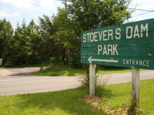
After flowing out of this retention pond and under North 8th Ave & Miller St, the Brandywine wends its way southwest for a hundred yards or so before entering Stoever's Dam Lake. The entrance to Stoever's Dam Park is off Miller St, as seen below.
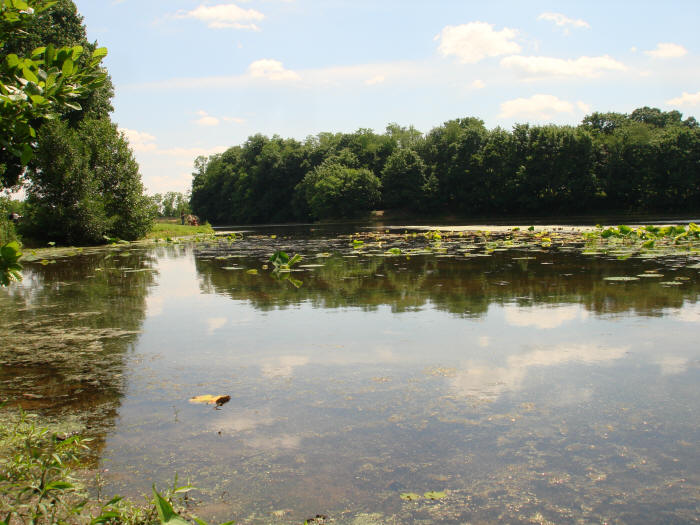
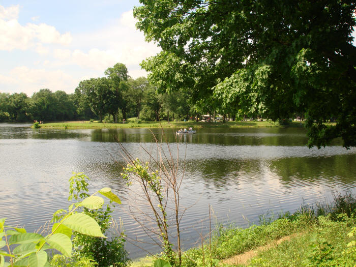
Below: Stoever's Dam Lake, with beds of water lilies in the foreground, on the west side looking south.
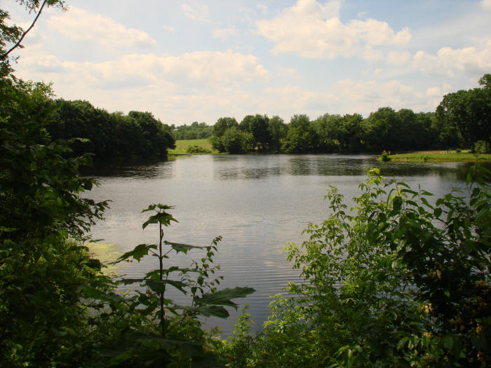
Next two photos: Stoever's Lake as seen from Stoever's Dam, looking north & then a bit east of north.
.jpg) Stoever's Dam was rebuilt in 1982
thanks to the "Save Stoever's Dam Project" chaired
by local residents Ray Artz, Betts Shultz, and E.
Peter Strickler, with many contributions from local
individuals, businesses & organizations, as seen on
the historic plaque at right that marks the entrance
to the wooden walkway across the top of the dam. The
walkway offers a great view of Stoever's Lake.
Stoever's Dam was rebuilt in 1982
thanks to the "Save Stoever's Dam Project" chaired
by local residents Ray Artz, Betts Shultz, and E.
Peter Strickler, with many contributions from local
individuals, businesses & organizations, as seen on
the historic plaque at right that marks the entrance
to the wooden walkway across the top of the dam. The
walkway offers a great view of Stoever's Lake.
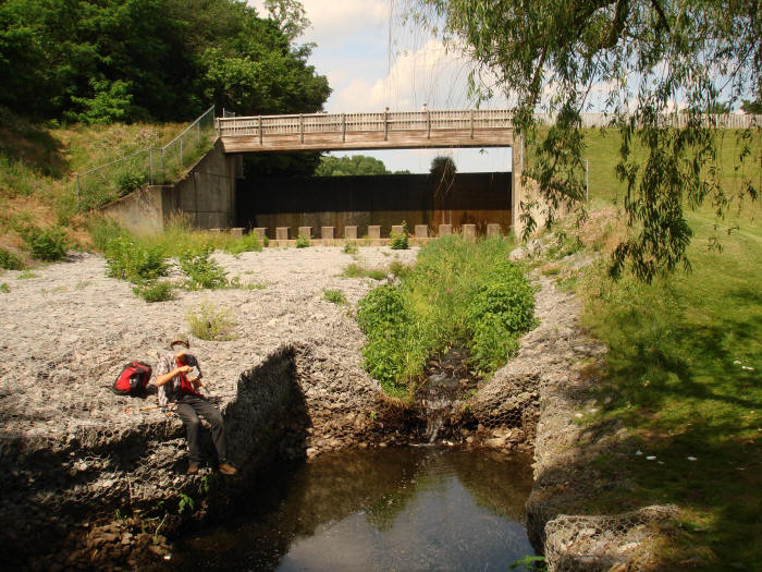
On the downstream side of the dam, a huge structure of wire-encased stones, called a "rock gabion," prevents erosion in case of rapid water discharge, as seen in the photo below (the face of the young fellow fishing has been obscured). The park's well-maintained ballfields lay just to the right.
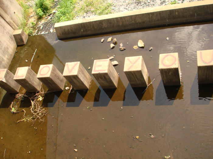
Below: Somebody Loves Jason: grafitti atop the concrete pillars at the foot of Stoever's Dam.
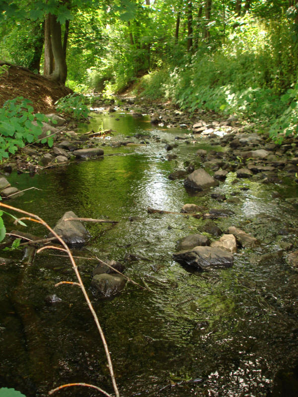
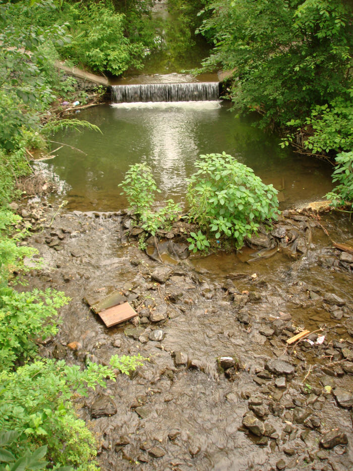
Below: Brandywine Creek becomes a stream again after passing Stoever's Dam.
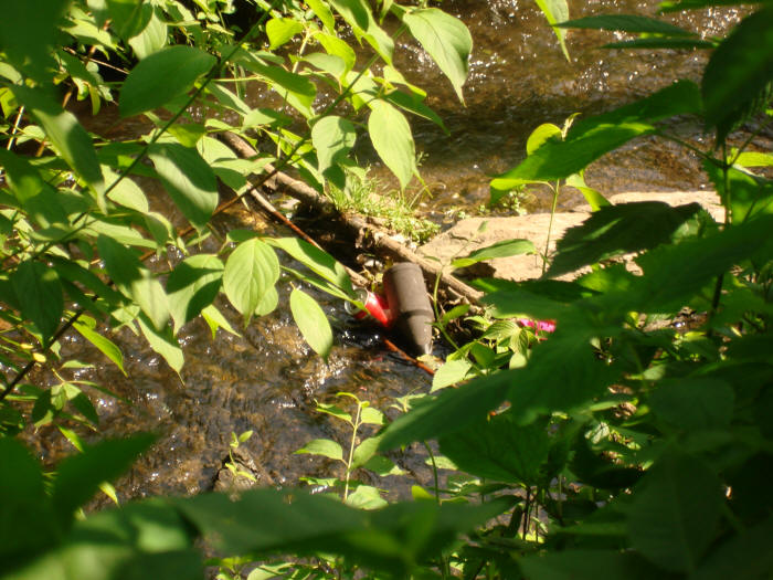
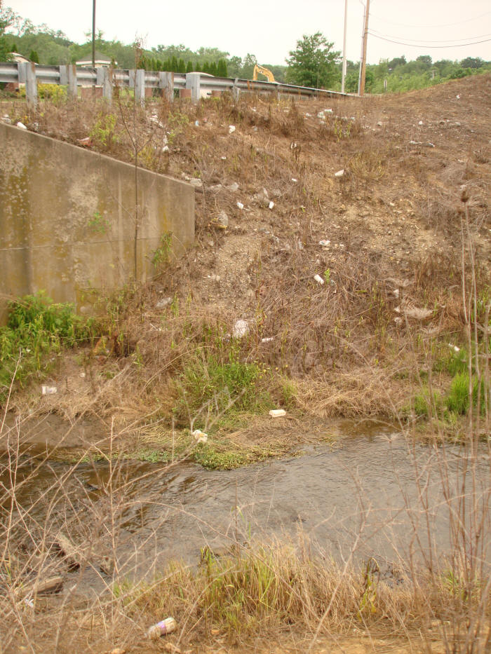
Below: The Brandywine flows under the bridge at N. 7th St & Miller St. Since leaving Stoever's Lake, the creek has coursed through several residential neighborhoods and picked up considerable trash. A discarded door serves as a makeshift bridge.
.jpg)
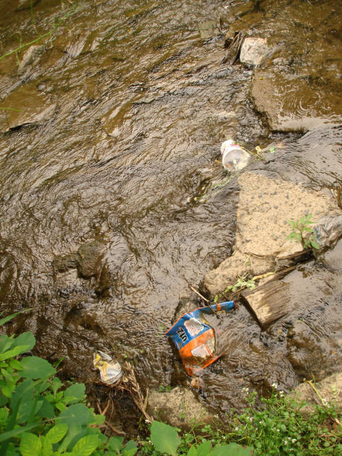
Below: Looking downstream from the discarded door-bridge — a rocky creekbed, stable banks, minimal silt, clear water, and frequent accumulations of trash. A pair of mallards paddle downstream.
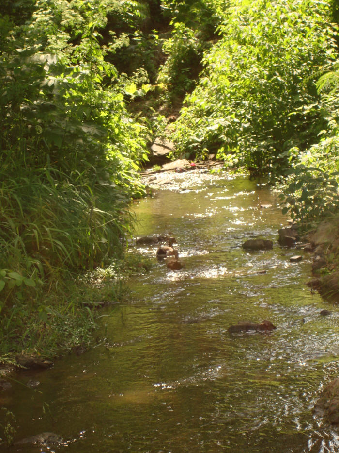
Below: A bit further downstream, still in a residential neighborhood and well before the Brandywine flows through a series of commercial & industrial districts.
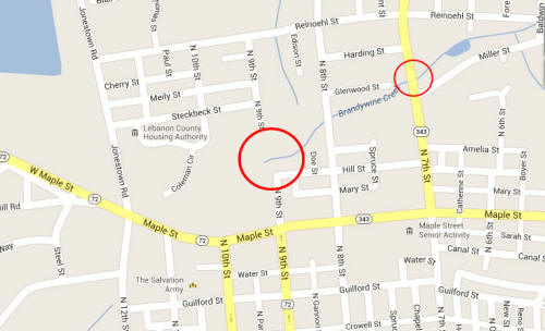 The photos above show
Brandywine Creek as it flows past the corner of
North 7th St & Miller St, as shown in the smaller
circle on the map at right. The next series of
photos show the area where the bigger circle is
drawn, just to the north & west of North 9th St &
Hill St. A steep hill descends into a thick
wooded area & dumping ground for asphalt & concrete
& all manner of things. Starting at North 8th
Street,
Brandywine Creek itself is channeled about 20 feet
underground into a large concrete culvert that
extends about a quarter-mile southwest across Maple
Street — which seems a good thing considering all
the trash & debris the creek would pick up were it
running on the surface.
The photos above show
Brandywine Creek as it flows past the corner of
North 7th St & Miller St, as shown in the smaller
circle on the map at right. The next series of
photos show the area where the bigger circle is
drawn, just to the north & west of North 9th St &
Hill St. A steep hill descends into a thick
wooded area & dumping ground for asphalt & concrete
& all manner of things. Starting at North 8th
Street,
Brandywine Creek itself is channeled about 20 feet
underground into a large concrete culvert that
extends about a quarter-mile southwest across Maple
Street — which seems a good thing considering all
the trash & debris the creek would pick up were it
running on the surface.
The captioned & labeled satellite Google Map below zooms in on the area around the big red circle in the map above. (© Google 2013.)
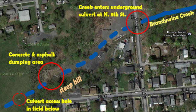
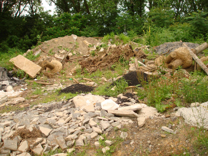
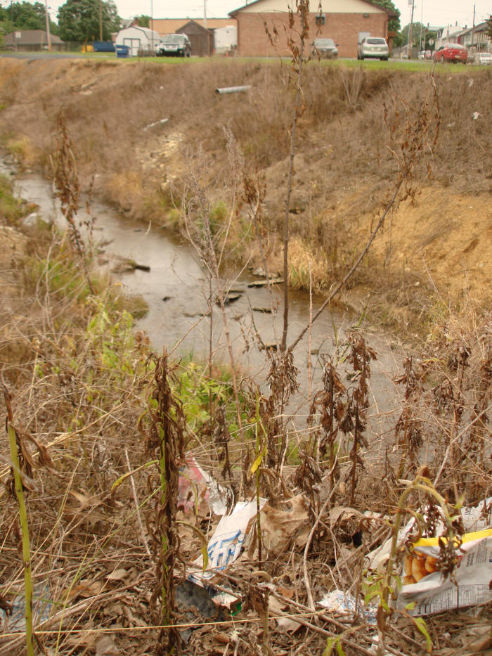
Below: Concrete & asphalt dumping area just downhill from the corner of Hill St & North 9th St.
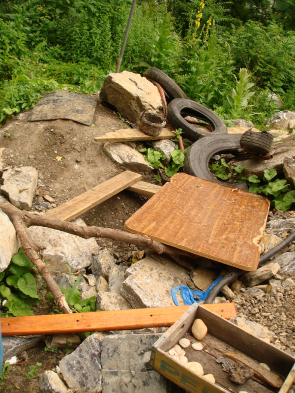
Below: A bit of order carved out of the chaos on the debris pile, by all appearances the result of the collaborative efforts of local youth in search of a secluded place to chill. Word.
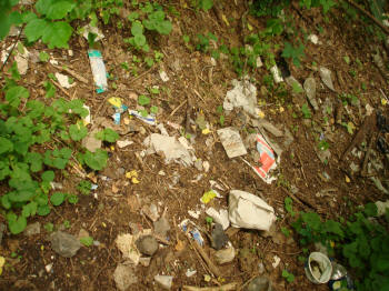
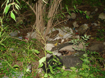
Below: The forest floor in the surrounding woods, thickly littered with trash. It seems fortunate for the Quittapahilla watershed that Brandywine Creek runs underground here.
Below: Access grate to Brandywine Creek running deep below in a concrete culvert, looking southwest, with Maple Street in the distance and the trash-laden woods behind.
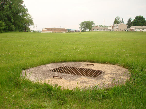
Below: Peering down about 20 feet to a culverted Brandywine Creek, flowing in at right.
.jpg)
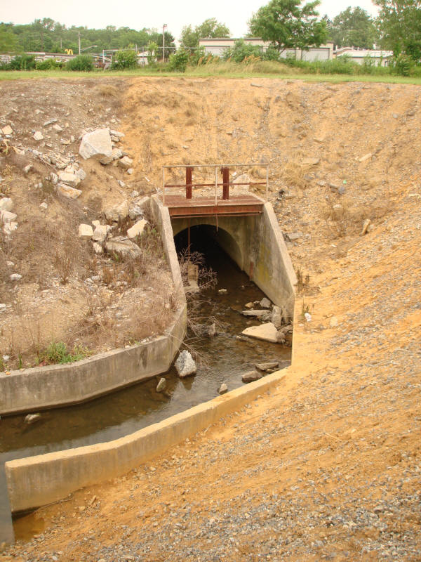
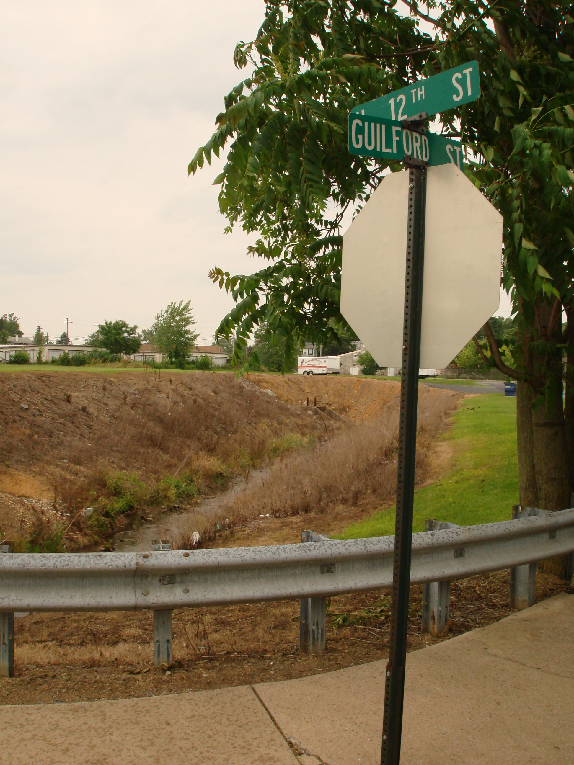
Below: Brandywine Creek, after crossing Maple Street, emerges from its concrete culvert near the corner of North 12th St & Guilford St.
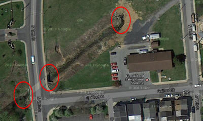 The modified Google satellite map
at right shows a bird's-eye view of Brandywine Creek
after it crosses under Maple St and comes out the
other side (© Google 2013). The circle in the
upper-right is where the creek comes out. The lower
circles (North 12th St & Guilford St) are the vantage
points for a series of photos below. Devoid of
vegetation, the banks along this stretch appear to have been sprayed
with RoundUp® a short time before these photos were
taken. Parts of the banks seem to be eroding
pretty severely. The whole structure has the look &
feel of a big open wound on the earth's surface. Inquiries are forthcoming.
The modified Google satellite map
at right shows a bird's-eye view of Brandywine Creek
after it crosses under Maple St and comes out the
other side (© Google 2013). The circle in the
upper-right is where the creek comes out. The lower
circles (North 12th St & Guilford St) are the vantage
points for a series of photos below. Devoid of
vegetation, the banks along this stretch appear to have been sprayed
with RoundUp® a short time before these photos were
taken. Parts of the banks seem to be eroding
pretty severely. The whole structure has the look &
feel of a big open wound on the earth's surface. Inquiries are forthcoming.
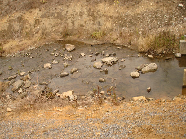
Above: Northeast bank of the North 12th St bridge over Brandywine Creek, June 2013. The lack of vegetation, the dead vegetation, the ongoing erosion, and considerable trash along this short corridor raise questions about its maintenance.
Below: Looking back from the bridge to the south bank.
.jpg)
Below: From the west side of the North 12th St bridge. A lesser, unnamed tributary flows into the Brandywine from the north through a concrete culvert.
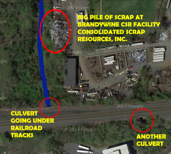
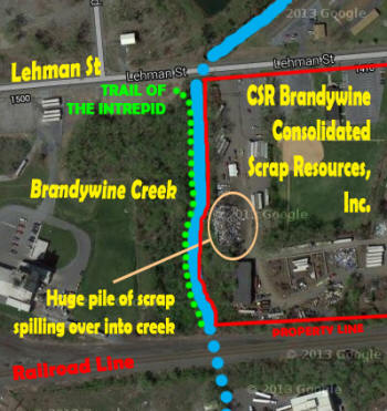 From here the Brandywine threads
its way through a business & residential corridor to
Lehman St. Crossing under Lehman, the creek runs
along the western perimeter of the property of a
company called CSR Brandywine Consolidated Scrap
Resources, Inc., as shown on the modified Google
satellite map at right (© Google 2013) and in the
photos below.
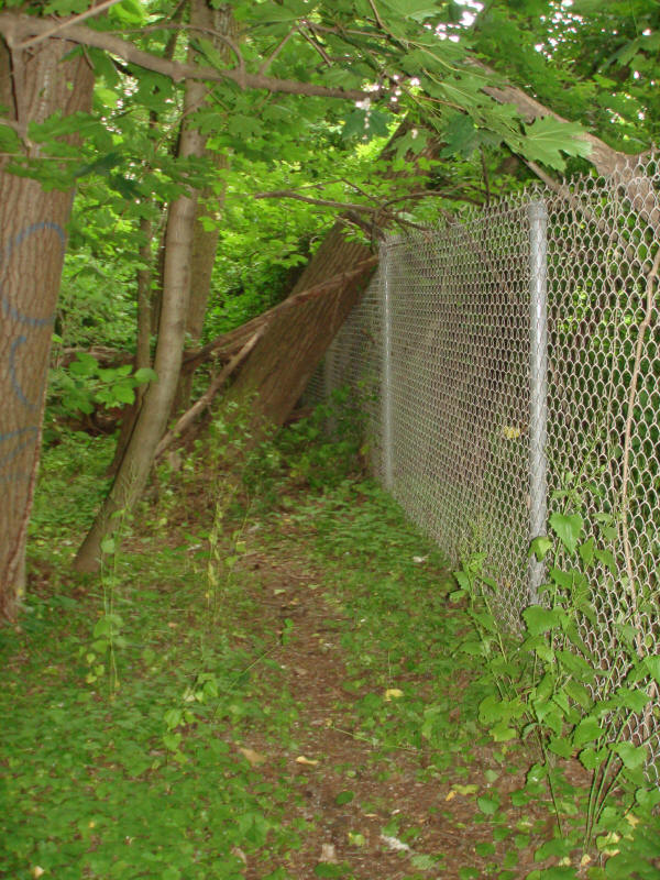
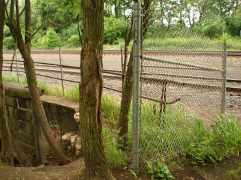
Here two parallel chain-link
fences block most of both sides of the channel, and
our little creek enters a strange & forbidding
place. That place is reached by a footpath on the
creek's western perimeter dubbed here the Trail of
the Intrepid. The trail runs about 200
yards north-south between Lehman St & the railroad
tracks.
From here the Brandywine threads
its way through a business & residential corridor to
Lehman St. Crossing under Lehman, the creek runs
along the western perimeter of the property of a
company called CSR Brandywine Consolidated Scrap
Resources, Inc., as shown on the modified Google
satellite map at right (© Google 2013) and in the
photos below.
Here two parallel chain-link
fences block most of both sides of the channel, and
our little creek enters a strange & forbidding
place. That place is reached by a footpath on the
creek's western perimeter dubbed here the Trail of
the Intrepid. The trail runs about 200
yards north-south between Lehman St & the railroad
tracks.
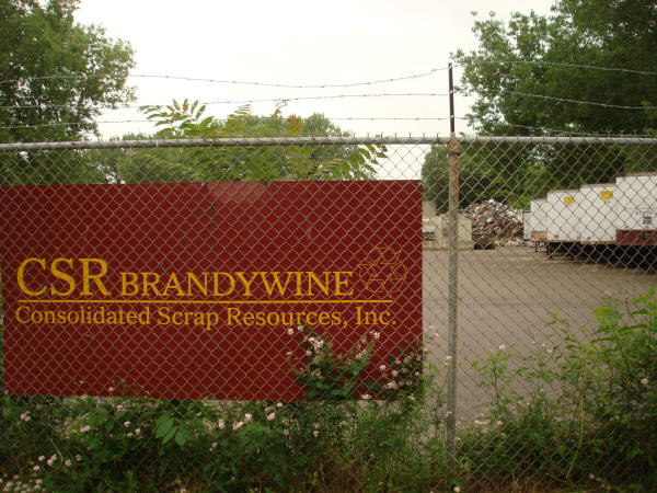
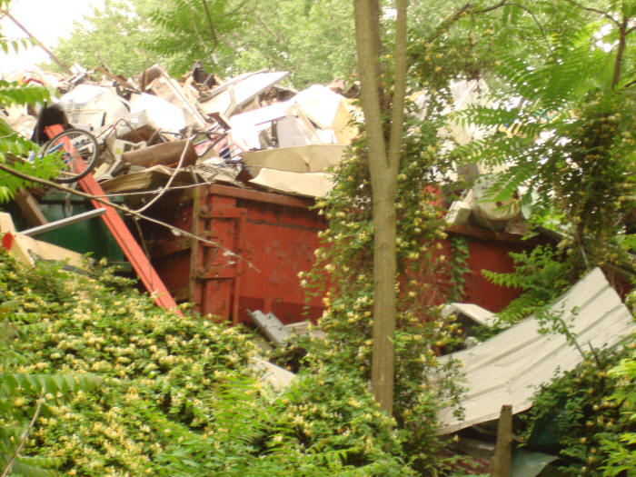
Below: Next to CSR Brandywine, Inc.'s main entrance off Lehman St. Note the big pile of scrap in the distance at right.
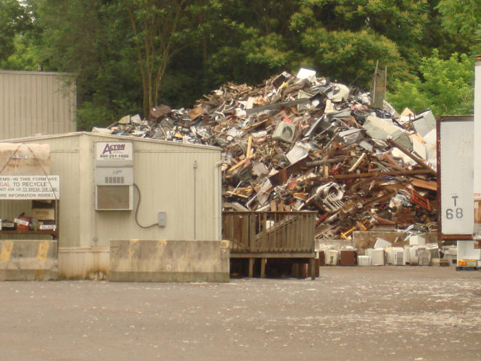
Below: A closer view of the big pile of scrap next to Brandywine Creek on the property of CSR Brandywine, Inc. All manner of electronic and other waste is piled at least 20 feet high. A row of junked air conditioners sits at the pile's base.
Below: The other side of this pile of scrap as seen from the west bank of Brandywine Creek, spilling down the east bank toward the creekbed and partly obscured by the thick vegetation.
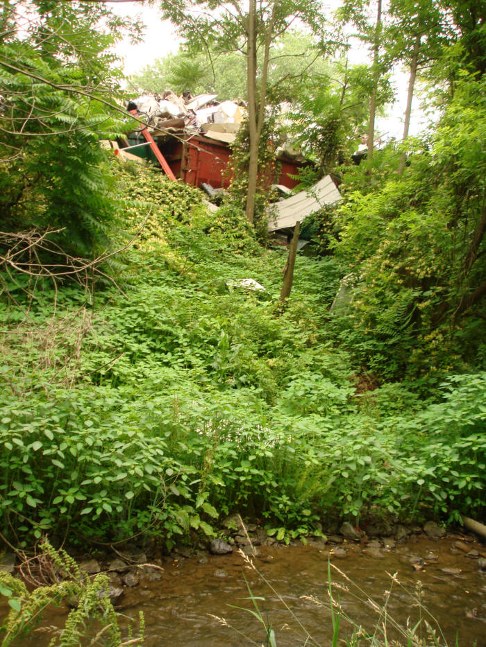
Below: Brandywine Creek bed along the border of the property of CSR Brandywine, Inc.
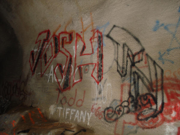
Below: The Trail of the Intrepid, looking north, with overgrown trees falling onto the chain-link fence at right (east). Beyond the fence & down an embankment flows Brandywine Creek. The trail is pretty well-worn and seems pretty frequently traveled. Many tree trunks are adorned with spray-painted graffiti. On the day these photos were taken, local youth could be heard hooting & hollering in the distance on the other side.
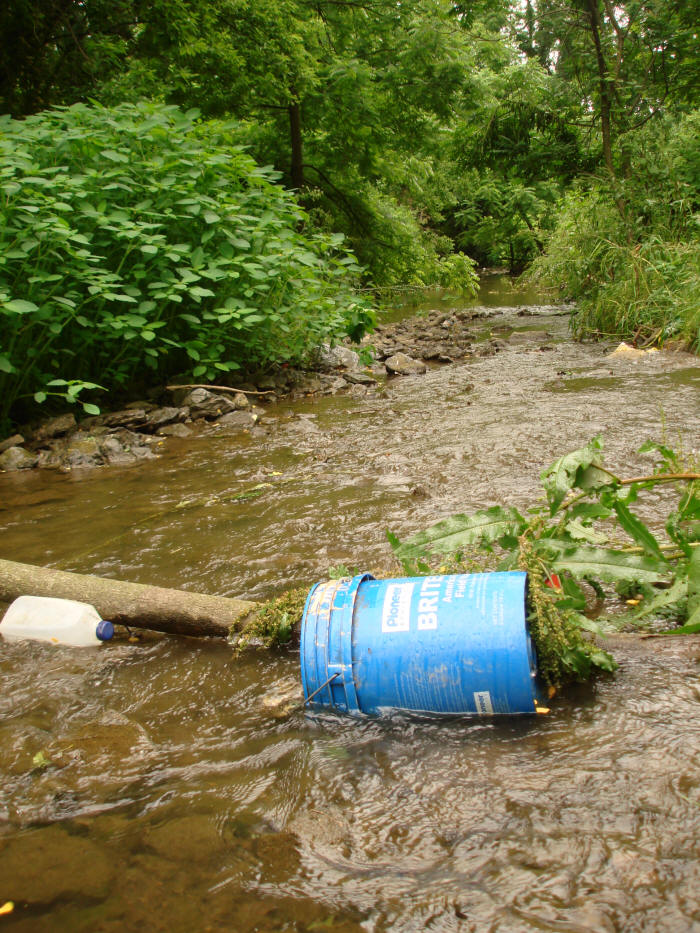
Below: Brandywine Creek between Lehman Street & the railroad tracks. The left (east) bank is the property of CSR Brandywine, Inc. Discarded tires, milk crates & other debris dot the creekbed. A pair of mallards scurries downstream.
.jpg)
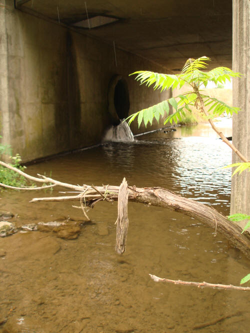
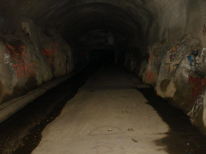
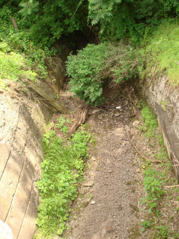
The Trail of the Intrepid ends at the railroad tracks. Here Brandywine Creek flows into an enormous culvert with a mouth at least 15 feet high and 20 feet wide. A discarded refrigerator lays on its side square in the middle of the culvert's mouth, the creek burbling gently past. A makeshift firepit holds the partly charred remains of spent packages of various products typically consumed by young people. The culvert smells dank. Its walls are covered with graffiti. Muffled echoes emanate from within. There is no light coming from the end of this tunnel.
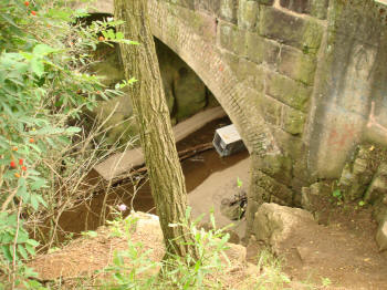
Below: From the culvert's mouth looking upstream.
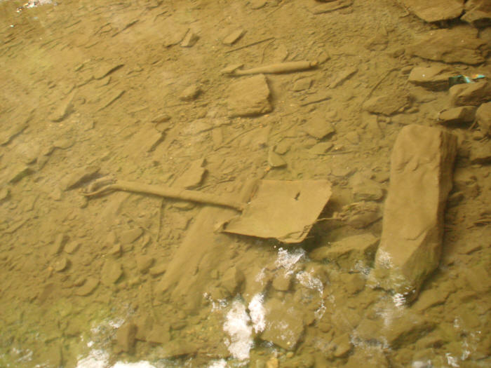
Below: Looking down from the culvert's lip through the water to the silt-covered remnants of a shovel, and a bit further on, what looks like an axe handle.
Below: Looking upstream from the culvert's lip, a makeshift firepit holds the partly burnt remnants a bunch of "Scene It?" cards (a trivia game focusing on movies, TV shows, video games & pop culture). The scene suggests a group of young people engaging in some kind of collective nocturnal ritual act, perhaps involving illicit mind-altering substances, meant in part to express & foster feelings of fraternity & shared identity while also paying homage to the weird & special qualities of this place. In other words, kids partying in a cave.
.jpg)
Below: Looking upstream from inside the culvert that runs under the railroad tracks, with the firepit at left and the creek flowing past the discarded refrigerator at right.
.jpg)
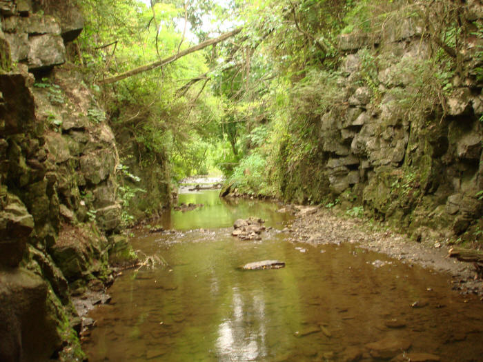
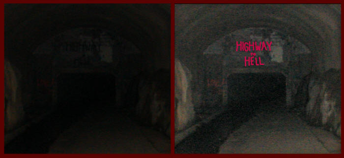
Below: Peering into the depths & shadows of the rail yard culvert. The tunnel narrows 30 or so yards up ahead into an underground channel apparently known locally as the Highway To Hell — words written above the narrowed entrance as seen in the second set of images below (at right, highlighting the lettering & brightening the background). Someday soon, on a day with no chance of rain, we'll return with a flashlight or three to inspect this approximately 1,800-foot culvert called the Highway To Hell.
Below: Returning along the Trail of the Intrepid to Lehman St, crossing Lehman St, and heading to the north side, we see the chain-link fence blocking the entrance to the creek channel and a sign warning against trespassing.
.jpg)
Below: Peeking through a void in the chain-link fence. Much of the creek bed & banks look to be of human fabrication, including this waterfall ledge. What appear to be discarded hinged wooden desk tops, a big hunk of some kind of textile, and various other debris litter the creekbed. At right, a yellowish scum pools on the surface.
.jpg) After reaching the railroad culvert,
the Brandywine disappears into the shadows. The
area under which it flows is zoned commercial & industrial and dominated
by large properties encircled with high chain-link
fences peppered with No Trespassing signs.
Some signs offer more pointed warnings.
After reaching the railroad culvert,
the Brandywine disappears into the shadows. The
area under which it flows is zoned commercial & industrial and dominated
by large properties encircled with high chain-link
fences peppered with No Trespassing signs.
Some signs offer more pointed warnings.
Heading west along Lehman Street, we enter West Lebanon Township's designated "Water Supply Area" (below) — another story entirely. But now we've left Brandywine Creek & its watershed behind. If we want to follow the creek to its mouth, we'll need to turn around.
.jpg)
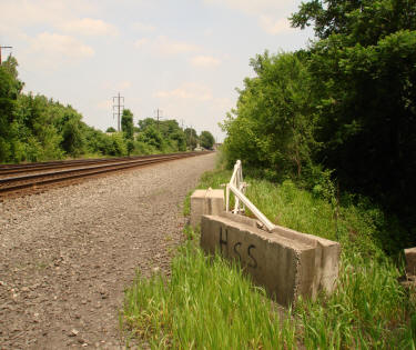
Where does the Brandywine emerge from its giant concrete culvert? A Google Map search reveals an abutment of some kind a hundred yards or so east along the railroad tracks, as shown on the modified Google satellite map, below left (© Google 2013). Below right, looking east down the railroad tracks heading into the heart of Lebanon City, we see the abutment at right.
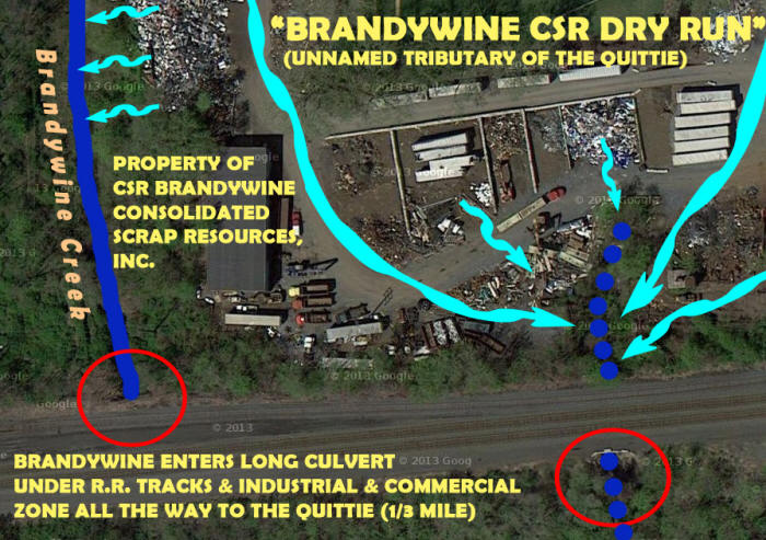
As we figured it's not the Brandywine. Instead it's a dry run, as seen several photos down. This unnamed tributary of the Quittie probably only flows after rainfalls. Funneled through a series of open channels & enclosed culverts, during periods of heavy rainfall it gushes directly into Quittie Creek's Hazel Dike.
The drainage of this unnamed dry run — let's call it Brandywine CSR Dry Run — raises troubling questions about the environmental impact of the CSR Brandywine's facility in Lebanon. The drainage area for Brandywine CSR Dry Run appears to coincide with the whole of the Brandywine CSR scrap yard. In other words, it appears that during periods of rainfall, the rain percolates through a series of large open piles of scrap, runs across paved lots & driving areas, down a steep little ravine, and through the railroad culvert into Brandywine CSR Dry Run & straight to Quittie Creek. This drainage pattern is sketched in the modified Google satellite map below (© Google 2013).
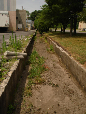
Below left: Brandywine CSR Dry Run as it comes out on the south side of the railroad tracks. Below right: Open-air section of Brandywine CSR Dry Run off Willow St., near the Quittie.
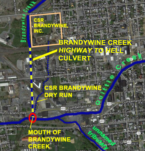
Below: A modified Google satellite map (© Google 2013) shows the final leg of Brandywine Creek's journey to Quittapahilla Creek through the Highway to Hell culvert, which extends about 1,800 feet underground from the north side of the railroad tracks all the way to the Hazel Dike. Here the mouth of Brandywine CSR Dry Run joins the mouth of Brandywine Creek.
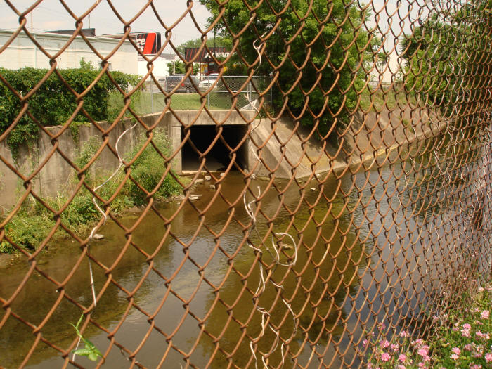
Below: The mouth of Brandywine Creek at Flynn's Hazel Dike in Lebanon as it flows out of the Highway to Hell culvert — a couple hundred yards east of the South 16th St. bridge, or off the southwest corner the Advance Auto Parts parking lot on West Cumberland St.
.jpg)
.jpg)
.jpg)
We hope you've enjoyed this virtual journey down Brandywine Creek's 1.7 mile path to Quittie Creek. As this photo-essay documents, the Brandywine is a severely impaired urban waterway that runs through a series of residential, commercial, and industrial zones after it leaves its headwaters near Stoever's Dam Lake, picking up all kinds of contaminants along the way — some visible, like soda bottles & chip bags & other kinds of urban street litter — and others less visible, like the toxins & noxious substances likely contributed by CSR Brandywine, Inc.'s open-air piles of scrap, which evidently include all kinds of electronic waste.
.jpg) Back upstream, folks up by
Stoever's Dam Lake take special care of the
Brandywine's headwaters, removing litter & trash
from the lake before it can be washed downstream —
people like local resident & fisherman Zach Hoffa,
who knows a gem of a local public resource when he
sees one. Would that the rest of Brandywine Creek
had comparable local stewards, committed to keeping
the creek clean & free of human-generated trash.
Instead, the Brandywine presents a disturbing
picture of chronic neglect & systemic contamination
from a range of urban & industrial sources. No
wonder Quittie Creek is so chock-full contaminants
by the time it leaves the Hazel Dike. If we imagine
a million Brandywines, all feeding their accumulated
trash & pollutants into the Susquehanna River, we
can begin to imagine the cumulative effect on the
Chesapeake Bay.
Back upstream, folks up by
Stoever's Dam Lake take special care of the
Brandywine's headwaters, removing litter & trash
from the lake before it can be washed downstream —
people like local resident & fisherman Zach Hoffa,
who knows a gem of a local public resource when he
sees one. Would that the rest of Brandywine Creek
had comparable local stewards, committed to keeping
the creek clean & free of human-generated trash.
Instead, the Brandywine presents a disturbing
picture of chronic neglect & systemic contamination
from a range of urban & industrial sources. No
wonder Quittie Creek is so chock-full contaminants
by the time it leaves the Hazel Dike. If we imagine
a million Brandywines, all feeding their accumulated
trash & pollutants into the Susquehanna River, we
can begin to imagine the cumulative effect on the
Chesapeake Bay.